Watershed GeoData LLC
Planning for what's next, wherever you are.
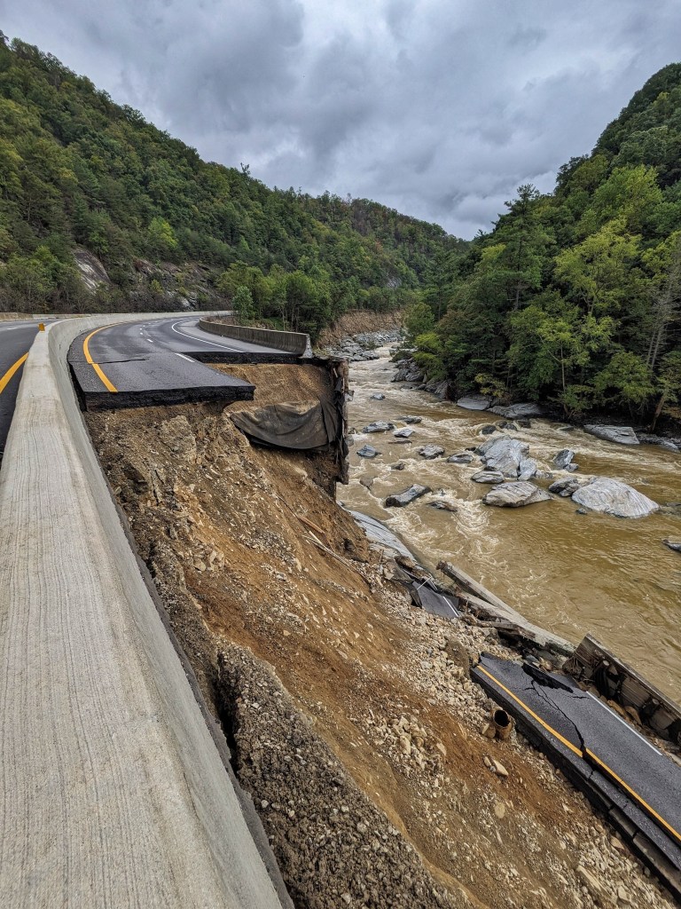
Disaster Program Management & Emergency Response Operations
Field-deployable operations planning and GIS specialist with program management experience on both the contractor and monitoring firm side of disaster debris operations
Experience That Protects Your Bottom Line
Disaster Debris Programs
- Managed multiple debris haulers and monitoring firms across large-scale disaster programs spanning dozens of jurisdictions
- Sponsor Site Inspection and ROE Management Systems
- Built contractor-side data systems superior to monitoring firms’ proprietary tools
Why Contractors Hire Me:
- I know where monitoring firms make mistakes: I’ve managed them
- I know what get denied: I’ve prevented millions in lost work
- I know contractor operations: I’ve embedded with field crews
- I’m self-sufficient: I mobilize with my own power, connectivity, and mobile workstation
Services
Embedded Field Operations
Deploy with your crews for active debris operations. Real-time data validation, load call verification, ROE management, and monitoring firm QA.
Ideal For: Contractors managing waterway debris, PPDR, or ROW operations who need embedded GIS support
Rate: Daily or monthly deployment rates
Remote Program Support
Monitor multiple jobs remotely. Dashboard development, operational visibility, monitoring firm data validation, and executive reporting.
Ideal For: Contractors managing multiple simultaneous operations who need centralized data oversight
Rate: Monthly retainer per active program
IMT Deployment Support
Self-sufficient GIS and UAS deployment to Emergency Operations Centers and Incident Management Teams. Situational awareness, damage assessment, and operational mapping.
Ideal For: Counties and IMTs needing rapid GIS deployment during active disaster response
Deployment: 24-48 hours, Southeast US
Qualifications
Program Management
- Hurricane Helene and Tropical Storm Fred Disaster Debris Operations Management
- Type 3 All Hazard Incident Management Team (O-305)
- ICS-300, ICS-400, G191 (ICS/EOC Interface)
Field Operations
- Haywood County IMT (GIS Specialist & UAS Pilot)
- Load calls, TDMS staffing, QA inspections
- FAA Part 107 Licensed Drone Pilot
- NRCS Level II Certified Conservation Planner
Technical Expertise
- ArcGIS Pro, ArcGIS Online, QGIS
- Python automation for data processing
- Power Platform (Power Automate, Power Apps)
- Dashboard development and reporting
Ready to Discuss Your Next Operation?
Whether you’re planning for hurricane season or managing active debris operations, let’s talk about how embedded GIS support protects your bottom line.
